How The Plan Was Created
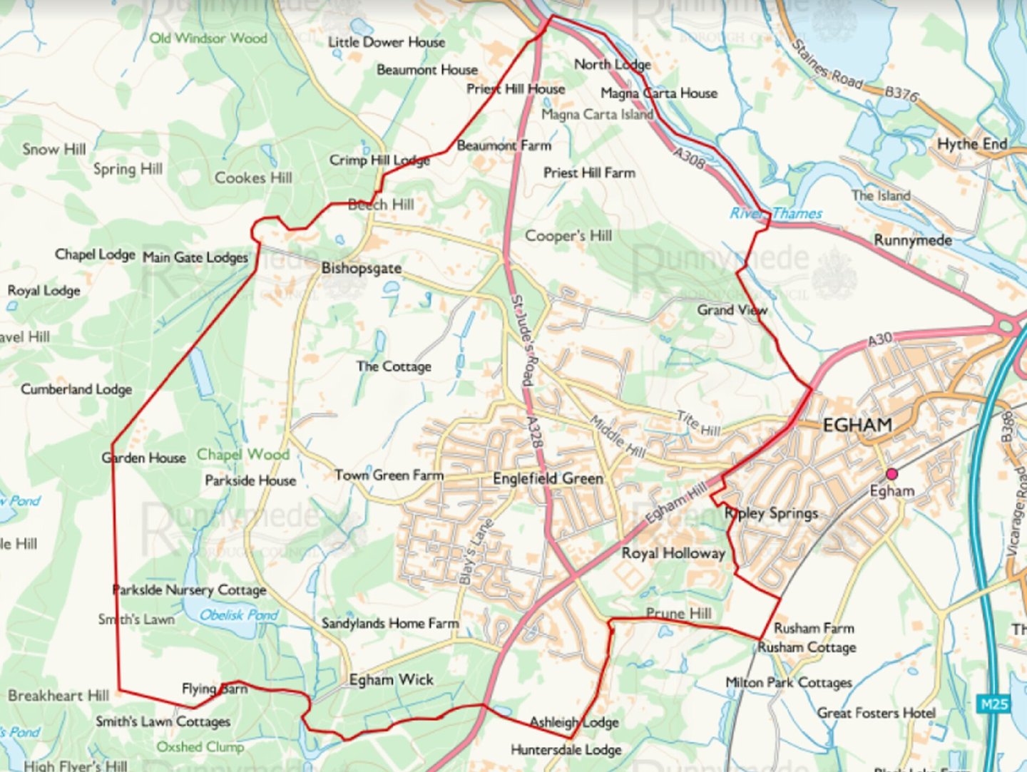
The area covered by our Plan is the East and West Wards of Englefield Green, shown on the map below.
The Plan itself is important as it strengthens and enhances some of the existing regulations that residents have indicated they care about. However, the Plan is constrained by the RBC Local Plan, which the Neighbourhood Plan must work in harmony with. We therefore produced a number of subsidiary documents that will also need to be taken into account by planners when assessing applications, these also give us a ‘road map’ for how you, the residents, have indicated you would like the village and surrounding area to develop.
The first of these is the Design Codes. These codes provide guidance as to what architecture, spatial configuration and designs we wish to see in our area. Planners will have to refer to them and applicants will need a very strong case if they do not follow them.
The second is the Placemaking document. Whilst we were limited in the Plan to private development regulations, this document contains aspirations for the public realm. Further research and public consultation will result in most proposals requiring modification and/or redesign and such dialogue will undoubtedly lead to

more proposals, but the key thing is that it forms a basis for discussion on how residents wish to see the public realm (ie the streets, parks and other areas) develop in the future. We have to emphasise it is most definitely not a set of fixed proposals , but is intended as a key tool to spark public discussion and action on strengthening the identity of the Area and making it a place we can all identify with and are proud to live.
The third is the Environment Report. This identifies where improvements to the ecology of the area could be made and makes recommendations as to how our environment could be improved.
Not only will the Plan be used by the RBC Planners to assess planning applications, but also the Community will be entitled to a minimum 25% of CIL income to spend on community infrastructure projects (CIL, the Community Infrastructure Levy, is a levy that developers in our area must pay to RBC if they get planning permission for a project).
Click here to read all the documents, you may also wish to visit Neighbourhood planning – Runnymede Borough Council
Projects undertaken by the Forum in Englefield Green are managed by EG Community Projects CIC
Co No: 15690744